Winter Park Ski Shop
Joe on Melody

Places

Places Articles

100 Years of Location, Location, Location

Real Estate and land ownership have always been important to the Granby area. With the passage of the 1862 Homestead Act by Congress, the West, including the area around the current town of Granby, began to be settled with hardy, ranching pioneers. The opportunity to own land was often made possible by homesteading.   This lured many settlers to the area.

As Congress adjusted the homesteading rules over the years to allow for larger acreages which would support ranching in the Middle Park, towns began to grow. Ranching, mining and especially the railroad fueled the growth. In 1902, railroad visionary, David Moffat, set events into motion in Denver to build a steam railroad from Denver to Salt Lake City which would be built over Rollins Pass.   This was a monumental task which led to the founding of the town of Granby.

Mary Lyons Cairns observed in her book, “Grand Lake in the Olden Days,” “Granby came into being with the Moffat Railroad, which reached that point in September, 1905. The town site was laid out on a piece of land which was part of a homestead and part of a pre-emption taken up by James Snyder from the government. Mr. Snyder sold this land to David Moffat who had the town site surveyed and platted in 1904, and a man named Hunter auctioned off the lots.”  

The lots on the town plat were 12 blocks and a Block “A.” Each block, except Block 12 and “A,” would have 32 lots. Each lot would be 25 feet by 125 feet. Block 12 only had 20 lots. Block “A” only had four smaller lots. David Moffat and the railroad in the form of the Frontier Land and Investment Company designed the town streets so that the southern boundary of the town was Agate Avenue, the western was First Street, and the northern boundary was Garnet Avenue. A variation in terrain in between Block 12 and Block “A” created Opal Avenue that would lead down Fifth Street which would be the eastern boundary of the new town of Granby.    

The new town streets were named Agate, Jasper, Topaz, Garnet and Opal, all precious gems which might reflect the mining heritage. But, in the King James version of the Bible in the Book of Revelation, Chapter 21, Verse 19, heaven is described as, “And the foundations of the wall of the city were garnished with all manner of precious stones. The first foundation was jasper…” Other streets and foundations are described as being made of precious gems such as topaz and chalcedony. Agate is described in the dictionary as a variegated variety of quartz or chalcedony.   Maybe the founders thought Granby was “heaven on earth.” Or, at least the real estate marketers wanted buyers to think that.

The real estate advertising in the December 16, 1905, Grand County Advocate showed V.S. Wilson as the local real estate agent for Granby. He also was the newspaper editor and became Granby’s first mayor on December 11, 1905. With that background, hyperbole and adjectives must have been in his blood.   “Now is the time to buy property at Granby-The newest and best town on the ‘Moffat Road.’…It would be a Happy Christmas investment. Do it now,” was part of the ad copy.  Mr. Wilson became one of the first land owners in Granby buying lots 18 and 19, Block 7 on Topaz from Frontier Land & Investment in November, 1905.  

When the railroad’s real estate company founded Granby in 1905, local historian, Betty Jo Woods, said the new town location was chosen because it had great connections with the stage route to Grand Lake, was mostly dry ground, and had pleasant views. As they say in real estate, the three keys to successful land investing are “Location, location, location!”   The locations of many of the historic buildings were on the north side of Agate Avenue. According to photographs and written explanations by the late Vera Snider, in 1920, on “main” street, one of the only buildings on the south side of the street was the firehouse which protected the fire pumper and hoses. The post office was also on the south side.   Vera Snider later arranged for the preservation of this historic structure built in 1910 by moving the first post office building in the 1960s from 458 East Agate where it had stood for over 50 years to its present location at 170 2nd Street.

According to the current owner of this historic structure, Deb Brynoff, “When Ron, my husband, was remodeling he found old letters in the wall from when it was the post office building.” It was not unusual during the early years of construction for letters and newspapers to be “stuffed” into the walls to help increase what little “R-factor insulation” existed.    Other early buildings which still exist in Granby are a home at 127 4th Street which was built in 1909. The current Re/Max Granby office at 247 Agate was a home originally built in 1909. Other early Agate Avenue buildings still thriving are Crafter’s Corner at 295 East Agate built in 1913 for the Granby Mercantile. Local lore says the basement was used as a temporary morgue during the 1918 flu pandemic. However, no historic research has yet been found to document this information.  

Research on High Country Motors at 277 East Agate reveal it was originally Middle Park Auto which grew up with the town of Granby. The tax rolls indicate 1913 for the birth of this building. The business was “born” in 1915 when Jack Schliz founded Middle Park Auto. During Granby’s early years this was a hub for locals. It even included a small medical-first aid station inside it before Granby had any local medical services. In 1938, the business was sold to Glenn Pharo and Morris Long. Later, Jack Shield was associated with the business. The authorized Ford dealership was later purchased by Fred Garrett, who later sold it to Mike and Kimberly Garrett.   The only constant on Agate Avenue is change. Many of the buildings have a colorful past. For example, the current location of Brown & Company at 315 East Agate was a Texaco Service Station built in the 1930s.

The Long Branch at 185 East Agate is in a building that was Granby’s first strip mall. That accounts for the many doors fronting on to Agate. Built around 1938 for the Craig’s Café, it has housed Olson’s Café, a Laundromat, a barber shop, The Carpet Wagon rug store and Maureen’s Clothing Store to name a few.   The Silver Spur Saloon & Steakhouse at 15 East Agate used to be the Grand Bar and Café run by Dick and Beulah Samuelson from 1944 to 1964. The original business at this location was the lettuce shed where the famous Granby Iceberg Lettuce was delivered by local growers for shipping to the Broadmoor Hotel in Colorado Springs. Some of the original lettuce shed has been incorporated into this building.  

The Dick Samuelson family also has a history with the Granby Mart at 62 East Agate. This building at one time was the home of Bud and Ken Chalmers’ Auto Repair Shop. In the early 1940s, it had a dirt floor when Sonny Samuelson and his Dad bought it. Clyde Redburn had a bowling alley on one side. The Samuelsons later put in more bowling lanes. Upstairs they had a club called “3.2.” At the time, those 18 and older could sip the 3.2 beer served there and dance. At one time Wayne Snyder’s Saddlery shared half of the store.   Sharing a location was the thinking behind the former Minnie Mall located at 480 East Age. Named by local businessman, Jack Applebee, for his mother, Minnie, in the 1980s, many businesses enjoyed the convenient location, The Furniture Store, Hobby Shop, Montgomery Wards, Honey Bear Children’s Clothing, Fabric Nook, Greg Henry’s Get-N-Pack, Radio Shack, Julie Sneddon’s Cards and Gifts, Patti Applebee’s Nimble Needle, Ben’s Aspen Leaf Café and the Shaft Shop which specialized in darts and dart supplies. Today, Granby Medical Center-Centura Health is at this historic downtown location.  

Granby’s historic story from 1905 to 2005 is one of building dreams, homes and businesses to create a community. Chinese Proverb says, “One generation plants the trees; another gets the shade.” How true.
2005


1873 directions to Hot Sulphur Springs

Hot Sulphur Springs (First published in 1873)

Location.—Middle Park, Summit County, Colorado  (now Grand County)

Access. – Go to Denver, via Kansas Pacific Railroad; thence, seventeen miles west, via Colorado Central Railroad, to Golden City; thence, thirty-two miles by stage, to Georgetown or Empire; thence, fifty miles horseback over Berthoud Pass. Or, from Denver, thirty-four miles west, via Colorado Central Railroad, to Central City; thence, fifty-five miles horseback over the James Peak route. Or, from Central City by wagon or carriage, fifty-five miles, over the South Boulder route.  Camp out on the way

Hotel.—One in contemplation.

Analysis.—None has been made. They are, however, said to be of the Sulphur class, and range in temperature from 111 to 116 degrees Fahr. Flow, two hundred gallons per minute.

Remarks.—These springs are no doubt destined to be a very popular resort. Situated as they are, on a mountain-bound plateau eight thousand feet above the level of the sea, under a cloudless sky, and surrounded by the attractions of mountain scenery and the chase, they cannot fail to receive visitors.

With all the inconvenience that attends a journey thither, and the necessity of camping out, over five hundred persons were there during the month of July, 1871.

The favorite route to the springs is by the way of Berthoud Pass. Having arrived at Georgetown, the tourist procures saddle and pack horses, and guides. The first day‘s journey will be over the summit of the range, eleven thousand feet above the sea, and through a dense forest of timber for fourteen miles beyond, to the “head of the park.” Here camp is usually made. The next day’s ride is down an open valley or arm of the park, following for some miles the course of Fraser’s River. The route by South Boulder Pass is tedious and difficult, the road passing over the extreme summit of the range, more than 12,000 feet above the sea, where snow-storms are not unusual in July and August. The James Peak route is one of the most interesting, the road winding around the mountain, one of the highest points in the range; and the ascent easily made. All the roads, however, after crossing the mountains, meet together in the valley of the Fraser River. Thence the road is a pleasant carriage-drive along meadow-like valleys, with timbered ridges or table-lands, to the right and left. The grass is of luxuriant growth, and great variety. Clover of several kinds, and the blue flowering flax, are seen everywhere. All through late spring and early summer the prairies are bright with flowers, and the air laden with their fragrance. Days or weeks can be whiled away in Arcadian simplicity and enjoyment. 

Arrived at the springs…...what a joy!


A Dream Smashed in Gore Canyon

The idea of a water passage from the Atlantic to the Pacific Ocean had long captivated the imagination of early explorers.  Soon after the Territory of Colorado was established, the United States government made a standing offer of $3,750 to anyone who could demonstrate such a route.

In 1869 a dreamer named Sam Adams convinced some people in the town of Breckenridge that goods could be sent upriver via the Mississippi, Missouri, Platte and South Platte Rivers to South Park.  Then, with a short portage over Boreas pass, they could continue down the Blue River to the Grand (Colorado) River and then through Gore Canyon the Sea of Cortez.

Volunteers were told they would share in the prize, and they built four boats of green lumber for the voyage.  The flotilla was launched with great celebration, the lead boat bearing a banner proclaiming "Western Colorado to California ? Greetings!"  A little dog was given to the crew to keep up morale.

As the boats went down the Blue River, the waters were a bit rougher than expected. When the men arrived at the Grand (Colorado) River, the crew set up camp. However several of the "sailors" declared they had had enough and began a trek, via dry land back home to Breckenridge.

When the boats reached Gore Canyon, they encountered violent upsurges and dramatic drops.  The wild waters smashed all four of the vessels on dangerous rocks.  Fortunately, all members made it to dry land, even the little dog.  No reward was ever given for the attempt.

Berthoud Pass
Berthoud Pass

Berthoud Pass was named for Captain Edward L. Berthoud, who completed the first survey of  this saddle in the main Divide in the spring of 1861.

Berthoud’s expedition of eight people, including Jim Bridger, crossed the Continental Divide at the 11,315 foot summit and established a relatively easy way to get into Middle Park from the east. Berthoud also served as chief engineer on the Colorado Central Railroad.

It is surprising that this famous pass had played no previous role in the history of the region. Even Jim Bridger, who knew the country well, did not learn of its existence until the survey. For reasons of their own, Indians had chosen to go over the divide at higher levels further to the north. One explanation may be that the pass is not evident from most locations on either side of the Continental Divide.

Church Park
Church Park

George Henry Church and his brother John had a substantial ranch in Jefferson Country, prior to Colorado Statehood.  When the Timber and Stone Act of 1878 was passed, it permitted the purchase of land unfit for agriculture for $2.50 an acre.  Thus the Church brothers obtained land in Middle Park for summer grazing.  They would move their cattle into the Park by driving them over the Rollins Pass.   The area they used is just west of the town of Fraser and became known as Church Park.

In 1910, the Church Ditch was created to divert water across the Continental Divide for irrigation.  The remains of this early trans-mountain project can still be seen today at mile marker 241.5 on U.S. Highway 40.

Colorado-Big Thompson Project

The idea of diverting water from the Colorado River on the Western Slope of the Continental Divide to the productive farmlands of the eastern plains had been a dream of planners as early as 1929.  Subsequently,  a long period of drought and the sagging economy of the “Great Depression” whetted demands for what became the largest trans-mountain diversion project ever built.

The Colorado-Big Thompson Project takes water from Grand Lake on the western side of the Continental Divide to the Big Thompson River on the east.  The water flows through a 13 mile tunnel beneath Rocky Mountain National Park.  In order to supply the residential and farming needs of Northeastern Colorado, the project was begun in 1938 and continued through the years of World War II.  The first water flowed though the tunnel, named for Senator Alva B. Adams, on June 23, 1947.

In order to assure an adequate supply from Grand Lake, a dam was built creating Shadow Mountain Reservoir.  A larger lake, Granby Reservoir was then built below, with a unique pumping plant that forces water into Shadow Mountain.  The Farr Pumping Plant cost over $9 million and provides an additional 700,000 of irrigated land to northeastern Colorado.  Further reservoirs were added, both to supplement the diversion and to compensate the water needs of Western Colorado.  These include Willow Creek and Windy Gap Reservoirs in Grand County.

While most legislators were enthusiastic about the project, U.S. Representative Edward Taylor was vehemently opposed to the reduction of water flowing down the Colorado River.  A compromise was reached in the creation of Green Mountain Reservoir (on the Blue River), which reserves water to replenish the Colorado River.   The city of Denver later claimed upstream water on the Blue River for the massive diversion project of Dillon Reservoir

Claims on the water of the Colorado River range from the fruit and wine regions of the Grand Valley in Colorado all the way to Los Angeles and Mexico.  It can be said that every snowflake which falls in Western Colorado had already been over-appropriated, especially during drought periods in the arid West.

Early Water Disagreements

As fast as settlers arrived in the county, conflicts arose over water use.  George T. Bell, an early rancher on the Blue River in the 1890's, had water rights coming out of Deep Creek, Spring Creek, and Soda and Iron Springs.  Daughter Maud Bell had married James Mugrage and when her father died in 1925, she and James stayed on the ranch of about 800 acres, to operate it.  She reported years later that when Noonen, a large rancher also on the Blue, built his ditch, he took much of the Bell water and used it for his own benefit.  Many years later, Maud discovered that although her father was long dead, those early water rights still belonged to the Bells, not the Noonens. 

Another family, that of George Henricks, settled far up the Troublesome Valley, about 1900, in what was truly an inaccessible spot.  What possessed him to pick such a remote area for his ranch?  Because when he and his wife Aurille lived in Nebraska and tried to make a living on their farm, farmers upstream stole their water to the point that they couldn't keep their crops alive.  Aurille actually had to use the same batch of water for two or three purposes!  As water fights escalated, George vowed to find a place where nobody could be above him and his water source. Rancher Will Call took him far up the Troublesome valley to a large meadow, reachable only by foot or horseback.  Life wasn't easy, for George and Aurille had to do everything from scratch, and they lived in a cabin with a dirt floor for many years.  But nobody took his water! 

Even more recently there was a case on Crooked Creek, where a ranching family that owned quite a good spring and used it to water their hay, discovered that a new neighbor was diverting the water from the spring over onto his own land, to water his own hay!  The rancher protested and diverted the water back where it belonged.  The newcomer turned around and stole it again.  This situation went on for many years without good satisfaction.

The Kirtz Ditch development on the Troublesome began about 1890.  In 1911, an Elias T. Copelin homesteaded land, later adjacent to the Alexander and George Murray Baker ranches.  One day Copelin and Murray Baker, one of the brothers, got into an argument over water rights in the Kirtz Ditch, each accusing the other of stealing his water.  Murray, who was a little guy with a fierce temper, picked up a shovel and gave Copelin a mighty whack with it.  Copelin fell to the ground but after a bit picked himself up, climbed on his horse, and headed toward his home.  However, the blow must have damaged his brain because he was found the next day, dead on the ground at his own gate

High on Meadow Creek, in the early 1900's, lumber activity began in the area later known as Sawmill Meadow.  About 1910, the Western Land and Flume Co. put in a little dam near what is now the trailhead to Columbine Lake.  The resulting lake, today filled with water lilies, was used as a holding pond for logs that would be moved by flume to the main mill downstream in Tabernash.  This lumber company sold to Western Box & Lumber Company in 1912.  Business flourished.  There was even a short railroad going into the woods, with the tracks made of logs about 6" to 8" in diameter.  Prospects looked good.  However, from the beginning water rights were an issue. Some people say it was Nathan Hurd who broke the company.  Western Box had lost some of its water to the Strawberry Ditch (going to Granby) in 1914.  More trouble was looming.  Hurd wanted to keep the water from the little reservoir for the ranchers and lettuce farmers below.  The timber folks wanted to use the water during the summer months to keep the flume going.  Nobody was willing to give up anything, so in 1915, the big mill closed.   Still, efforts continued.

Then in 1919, the planing mill at Tabernash burned.  In the early twenties, further contention led to the withholding of more water from the lumber companies who wanted permission to ditch Trail Creek water across into Meadow Creek, replacing water taken higher up for the flume and Strawberry Ditch.  This would have been quite easy because, about seven miles out of Tabernash is a nearly flat saddle that exists between the two creeks.   Nevertheless the Hurds wouldn't hear of it.

Then one Henry Jarvis showed up on the scene.  He was known to all the timber men.  In 1923, Jarvis, using a box of TNT, "blew the dam" of the irrigation reservoir at Western Box.  People suspected that he did it for T.S. Huston, one of the big lumber powers of the area.  The feeling was that "if the lumbermen couldn't have the water, neither could the ranchers and the Granby farmers."  In any case, that basically was the end of Western Box Company. 

Five Middle Park Veterans - Members of the Powell Expedition

On May 24, 1869, Major John W. Powell embarked on an expedition to fill in the final unknowns on the map of the American West. Among his nine-man crew were five veterans of the Civil War from Middle Park, unaware that by joining Powell’s discovery expedition they would find their own immortality.  

Corporal John "Jack" C. Sumner served in Company E, 32nd Iowa Volunteer Infantry in the Civil War. His sister Elizabeth Byers brought him to Colorado in 1866.  W.N. Byers, editor of the Rocky Mountain News, employed Jack as caretaker of the Middle Park Hot Springs. Sumner set up a trading post for hunters and trappers. Bill Dunn, Billy Hawkins, Oramel Howland, and Seneca Howland were all customers. 

Major and Mrs. John Wesley Powell visited the springs in 1867. Nearby, the headwaters of the Grand River flowed. Powell and Sumner planned to navigate the Grand, Green, and Colorado Rivers to the Gulf of California. Sumner convinced his colleagues to join the Colorado River Exploring Expedition. Only Sumner made it to the Gulf. He died July 5, 1907, leaving a widow and three sons.

page6image62730048

Private William H. “Bill” Dunn served with Co. K, 15th Ohio Vol. Inf. After service, he came to Colorado. Powell said of Dunn, “He dresses in buckskin with dark luster, and has a contempt for razors and shears.” Dunn left the expedition at Separation Rapid, Arizona, and was subsequently killed.  No photos of Dunn exist today. Artist’s interpretation courtesy of Hannah George.

Oramel G. Howland was a printer at the Rocky Mountain News, and VP of the Typographical Union. He was associated with the Methodist publication The Sunday School Casket. Powell said Oramel had a “King Lear” look. At age 36, he was the expedition’s mapmaker. His fate was the same as Dunn’s.

page6image62718736 

Pvt. William R.W. “Billy” Hawkins enlisted with Company D, 15th Missouri Vol. Cavalry. Hawkins came to Colorado as a bullwhacker. He was the expedition’s cook and last survivor, passing away in Arizona at age 70, on June 7, 1919.

page6image62718624

 A half-brother of Oramel, Seneca B. Howland was a member of Co. G, Vermont Vol. Inf. Brigade. At age 26, he shared the same demise as Oramel and Bill Dunn.

page6image62727472

2019 marked the 150th Anniversary of the Powell Expedition.  

Fraser
Fraser

The origin of Fraser was in 1905 and it was incorporated in 1953. It was formerly known as Eastom, for George Eastom, who laid out the town site in 1871. The spelling of Fraser was originally Frazier, after Reuben Frazier. The town came into being because it was the site of a large sawmill and was a railroad terminus for the lumbering operation.

While Fraser was generally considered to be an isolated mountain outpost, at one point there was enough cultural interest to support a local opera house.  Fraser was the location of a weather station for several years and during that time it was not uncommon for the winter temperatures to be 45 to 50 degrees below zero; one Fraserite remembers a morning when it was 60 degrees BELOW zero. Thus the town earned the nickname “Icebox of the Nation.” After a legal battle, that offical title went to a town in Minnesota.

A transcontinental motor route dubbed the Midland Trail came through Grand County and by 1913 a Ford sales agency was located outside of Fraser on the 4 Bar 4 Ranch. Avid fly fisherman President Eisenhower was a frequent visitor between 1948 and 1955.

Fraser Valley
Fraser Valley

The principal population centers in the Fraser River Valley are Winter Park, Fraser and Tabernash.  When the early stage coaches came over Berthoud pass into the Fraser Valley, the most popular stop was at the Cozens Ranch, which now houses a historical museum in Winter Park. The valley is now bisected by U.S. Highway 40, which was designated the "Victory Highway" in 1931.  The new route of the highway leads through the main streets in both Fraser and Tabernash and the backdoors of some business became front doors because of the new highway alignment.   

Tabernash was the name given to a railroad siding, named for the Ute leader who was killed during a confrontation with local ranchers.  The town became a key station on the railroad line, and included a roundhouse, and a supply of helper engines for the steep climb over Rollins Pass.  When the Moffatt Tunnel was opened in 1928, the railroad no longer needed service there and the town lost its' main economic support.

George Easton founded the town site of Fraser in 1905.  The rest of the country became familiar with Fraser when the winter temperatures were often the lowest recorded in the U.S. and Fraser was know by the nickname "Icebox of the Nation".   Lumbering was one of the prime industries in the region until World War II.  During the war, the military built a Prisoner of War camp at Fraser to help lumber for the mills in the area.

The current area of Winter Park has had many names over the years.  First it was called simply "Old Town" or "Vasquez", named after the fur trader Louis Vasquez.  "Woodspur" or "Woodstock" referred to Billy Wood's lumber mill in the area, which furnished ties for the railroad while it was being built over Rollins Pass. During the construction of the Moffatt Tunnel, the name "West Portal" came into usage.  Rail workers also called the community "Little Chicago" as it was as it was a favorite gambling, saloon, and brothel site.  As tourists began to arrive it was known as "Idlewild" and also "Hideaway Park".  Finally, the name "Winter Park" was settled upon to correspond with the adjacent ski area of the same name.

The area population declined from 1232 people in the 1920's to only 373 people by 1930.  The Great Depression ended the construction boom and the price of beef became too low for ranches to turn a profit.  However, since that time, the area has thrived, mostly based on a tourism economy.  The valley's main source of income is now recreation and second home construction. 

Articles to Browse

Topic: Mining

Mining

Ghost towns and broken dreams are legacies left by the early miners and prospectors of Grand County. Ever since 1879 when the first mines were staked out and claimed on Bowen Mountain near Grand Lake, “gold and silver fever” grew like an epidemic. Men blinded by greed and prospects of a better tomorrow scrambled to the Kawuneeche Valley with picks and shovels to unearth their fortunes. Women worked just as feverishly along side their men and encampments gave way to mining towns almost overnight. Land offices, eateries, and boarding houses sprouted like wild flowers.

Claim jumping became a common practice, resulting in fights and even murders. Most of these injustices would go unpunished, for no one wanted to risk losing their chance of riches. In Grand County the mother load was a false prophecy, as only small quantities of low grade gold, silver, and lead ore were found. In a few short years, Gaskill, Teller City, and Lulu City, three of the more noted settlements, suffered the same fate as the other boom towns. By 1885 the mining boom had ended in Grand County and ranching had taken it’s place as a sustaining industry.

Topic: Water

Colorado-Big Thompson Project

The idea of diverting water from the Colorado River on the Western Slope of the Continental Divide to the productive farmlands of the eastern plains had been a dream of planners as early as 1929.  Subsequently,  a long period of drought and the sagging economy of the “Great Depression” whetted demands for what became the largest trans-mountain diversion project ever built.

The Colorado-Big Thompson Project takes water from Grand Lake on the western side of the Continental Divide to the Big Thompson River on the east.  The water flows through a 13 mile tunnel beneath Rocky Mountain National Park.  In order to supply the residential and farming needs of Northeastern Colorado, the project was begun in 1938 and continued through the years of World War II.  The first water flowed though the tunnel, named for Senator Alva B. Adams, on June 23, 1947.

In order to assure an adequate supply from Grand Lake, a dam was built creating Shadow Mountain Reservoir.  A larger lake, Granby Reservoir was then built below, with a unique pumping plant that forces water into Shadow Mountain.  The Farr Pumping Plant cost over $9 million and provides an additional 700,000 of irrigated land to northeastern Colorado.  Further reservoirs were added, both to supplement the diversion and to compensate the water needs of Western Colorado.  These include Willow Creek and Windy Gap Reservoirs in Grand County.

While most legislators were enthusiastic about the project, U.S. Representative Edward Taylor was vehemently opposed to the reduction of water flowing down the Colorado River.  A compromise was reached in the creation of Green Mountain Reservoir (on the Blue River), which reserves water to replenish the Colorado River.   The city of Denver later claimed upstream water on the Blue River for the massive diversion project of Dillon Reservoir

Claims on the water of the Colorado River range from the fruit and wine regions of the Grand Valley in Colorado all the way to Los Angeles and Mexico.  It can be said that every snowflake which falls in Western Colorado had already been over-appropriated, especially during drought periods in the arid West.

Topic: Leisure Time

Leisure Time

Of all the leisure time activities available to the pioneers, dancing was the favorite. Dances were held in grand hotels that remained from the mining boom, such as the Fairview House and The Garrison House in Grand Lake. Quadrilles, a type of square dance, were popular at the time. A fiddler would provide the music and serve as the caller. These parties would start in the evening and last all night.

The formidable temperatures and great traveling distances were incentive for getting the most out of every gathering. Winter Sports have also always been a popular pastime. Skiing was introduced to the region during the winter of 1883. Snowshoeing and sleigh rides were also enjoyed. 1882 officially brought the arts to the Grand Lake area when the Dramatic Society was organized. A production of the well-known comedy "Our Boys" was the premiere performance.

Barger Gulch - Archaelogical site

The prospect of discovering a remnant from a 10,000-year-old stone age society that inhabited Colorado's Middle Park so long ago seemed remote at best - while the suggestion that a prized Folsom point could somehow materialize before our very eyes appeared all but impossible.  For one thing, it was the last day of excavating for the summer at the Barger Gulch archaeological site and the ten member scientific team would soon be packing up and heading back to their ivory towers at the University of Wyoming and the University of Arizona.

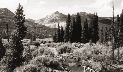
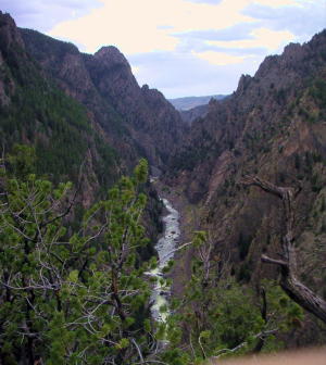
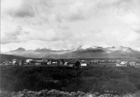
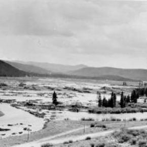
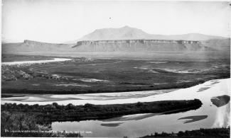
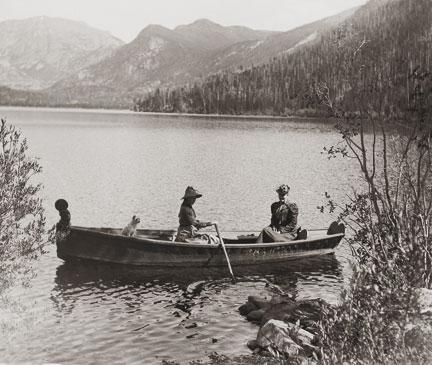
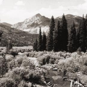
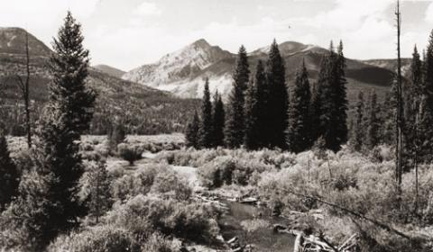
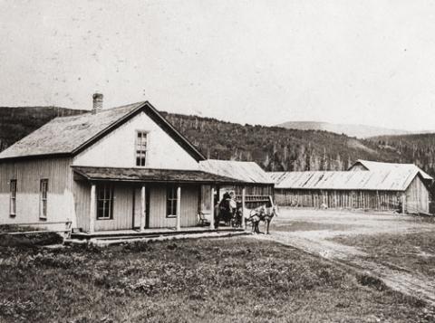
Barger Gulch is a desolate spot that the federal Bureau of Land Management (BLM) oversees. It is hard, parched dirt dabbled with sagebrush as far as your eyes can see across the flat valley - a haven for all manner of bugs and other forms of native wildlife. In winter, the place turns to the opposite extreme as temperatures plunge to minus 40-degrees and howling winds whip up ghostly images of snow that swirl eerily across the land. This is Middle Park, a high mountain basin with roughly the same geo-political boundaries as Grand County. It encompasses some 1,100 square miles of unforgiving territory flanked on three sides by the formidable wall of the Continental Divide and its terrain soars high over the Great Plains into the thin, alpine air up to altitudes of 13,000 feet above sea level. What would induce these primitive Americans to trek all the way up here without so much as horses for transportation? How would they have survived the brutal winters with only primitive tools and clothing?  And why in the world would they ever want to settle in such a barren, god-forsaken place as Barger Gulch? 

This site could well prove to be one of the most significant archaeological discoveries of its kind in North America, according to BLM officials who oversee the project here. In just three years of work in a relatively small excavation area, investigators unearthed more than 18,000 artifacts - a staggering number ten times that discovered at typical Folsom sites. And this is only one of four sites in the same vicinity.  In addition to Barger Gulch and Upper Twin Mountain, discoveries include the Jerry Craig and Yarmony Pit House sites. Most of these were occupied by peoples described by archaeologists as Paleo-Indians, a catchall term for ancient humans that inhabited North America; Yarmony Pit House post dated Paleo-Indians by about 3,000 years.

But long before Paleo-Indians ever set foot on the Continent, Middle Park was a prehistoric menagerie; 20-million years ago, it was the stomping grounds for prehistoric rhinoceros, three-toed horses, camels, giant beavers, and even small horses. Creatures known as oreodonts also romped across the mountainous terrain. These vegetarians, ranging in size from small dogs to large pigs, fed on grasses and green, leafy plants. In fact, the skull of one of these animals was discovered recently in the vicinity of Barger Gulch. These long extinct, hoofed animals resembled sheep, but were actually closer to camels, and were common in the western U.S. This latest discovery is remarkably well preserved; while the bones have turned to stone, the smooth, hard enamel that encased the animal's teeth is still intact. 

Humans arrived in North America much later - about 12,000 years ago - as the last Ice Age of the Pleistocene Epoch made its exit. These first Americans crossed a land bridge from Siberia to Alaska and began populating the entire Continent; experts believe it is possible they also arrived on boats following the Continental Shelf into North America. Folsom people are best known as nomadic, big game hunters who chiseled out their spear points and finished them off with a distinctive, artistic flourish - a unique groove, or flute, that runs lengthwise along the face that has become the symbol of this Paleo-Indian culture. They honed the tips of these primitive weapons surprisingly sharp for killing frenzies that were necessarily up close and personal: they herded their prey into traps before launching their spears - and archaeologists suspect there was just such a bison ambush site near Barger Gulch. The quarry just over the rise is a gold mine of raw materials, including fine-grained Kremmling chert and abundant Windy Ridge quartzite, which provided a never-ending supply of top grade stone. "It makes sense," explains Todd Surovell. "You would want to camp where you could get as many raw materials as possible within a short distance. That's where you're going to park yourself for awhile."

The bulk of these tools originated with local material, but investigators have found some 200  "exotic" items noticeably out of place at Barger Gulch. One is a distinctive piece of yellow, petrified wood that came from 93 miles away as the crow flies, near the town of Castle Rock on the Colorado plains. Another is a large biface that was brought up from the Arkansas Valley, some 60 miles south. "They worked on it up here in one place and turned it into two, maybe three projectile points," notes Surovell. "One of them broke during manufacture and we have two pieces that fit exactly together."

Fitting these and thousands of other pieces together is what archaeologists do when they get back to the lab. The process begins on site where investigators photograph each find and record its exact location within the excavation block. This gives the team a visual reference to help recognize activity patterns - a way to connect the dots of Folsom society.  But the specks come to an abrupt stop, as if they suddenly run into a solid wall. "If we could figure out that this represented the wall of a structure, that would be really special," he explains. "Nobody's even been able to do that before in a site of this age in North America." Just then, a graduate student pops his head inside the door. "You want to be a camera man?" he asks Surrovell. "What do you got?" "A Folsom point," he replies with a broad grin. We rush over to the site where Waguespack has dug a narrow shaft down the north wall of the excavation pit and hit pay dirt - a Folsom point that remains half buried in the stratum of rich soil.

Topic: Mining

Teller City, Crescent City and Tyner

The original Grand County contained North Park as well as Middle Park, and during the mining boom of the early 1880's there were several mining camps east of the modern town of Rand. It was several years after the mining boom northern area of Jackson County was created.

Teller City was founded in 1879 and named for Colorado's famous Senator Henry M. Teller, who later became U.S. Secretary of the Interior.  By 1882, the population of Teller City was about 1200.  It had a fine hotel with 40 rooms, a newspaper and two steam saw mills.  It was a lively Old West town with twenty seven saloons and a number of "houses of ill repute".

Some high quality ore assayed at Teller City was as much as $3000 a ton, but most of that soon ran out and by 1884, the high shipping costs to far away smelters dropped the price per ton dropped to $20. The best mine, Endomile, was three miles from town.

Crescent City, southwest of Teller City had an even more brief existence, but there was population enough for a U.S. Post Office in 1880. 

Rumors of valuable silver three miles sough of Teller City drew a number of prospectors to found the camp known as Tyner.  John Noble Tyner was the First Assistant Postmaster General of the United States and visited the mining camp so named in 1879.  He promised the miners a weekly mail delivery if at least 2 miners mined through the winter.  Tyner had been a special agent for the Post Office from 1861 thru 1868, at which time he was appointed to serve in an open seat in the U.S. House of Representatives for Indiana.  He ran for election win the appointed term ended and was elected and continued to be reelected and serve as a Representative until 1875 when President Grant appointed him Second Assistant Postmaster General.  Grant would later appoint him to the "big job" of Postmaster General in 1876. 

Tyner worked to elect Rutherford B. Hayes in 1876 and after Hayes was elected and took office in March of 1877, Hayes appointed a new Postmaster General, but gave the second spot, First Assistant to the Postmaster General to Tyner.  Historians suggest that Tyner's demotion angered him to the point that he allowed wide spread corruption in the day to day operation of the Postal Service which was his responsibility to over see. He resigned in 1881 under great public pressure from what became known as the "Star Route Fraud scandal".  He would remain a political figure  being appointed  various positions  with the U. S. Postal Service until shortly before his death in 1904.  Although indited three times for corruption in his Post Office management, he was never convicted.  The "Star Route Fraud scandal", may have local implications.  It had to do with over charging and providing needless postal routes, roads and post offices and kick backs to politicians from contractors .

Topic: Towns

Winter Park

The town of Winter Park was first settled in 1923 and incorporated in 1978. It came into existence as a construction camp during the building of the Moffat Tunnel. The west portal is located here, hence the original name of West Portal.

As early as 1929 hearty winter sports enthusiasts were getting off the regularly scheduled trains there to ski the trails that were being developed. Regular weekend service on a special ski train began in January 1938. That same year, the U.S. Forest Service gave permission to the City and County of Denver to develop land near West Portal for winter sports, constructing ski-tows and trails. Winter Park ski area was formally opened in 1940.

With the consent of postal authorities, West Portal’s name was changed to Winter Park to publicize the ski area.  Benjamin F. Stapleton, the mayor of Denver at the time, championed the cause of the name change to help publicize the winter sports of the area. The town has now grown into a classic resort town and the ski area management has been recently turned over to the Intrawest Corporation by the City and County of Denver.

Topic:

Irving Hale's Adventures in Grand County

Article contributed by Abbott Fay

At the age of 17, Irving Hale was the first graduate of the Denver Hugh School in 1878. That summer, he and his younger brother decided to go to Grand Lake to catch trout with the plan to sell the fish in Central City and make a tidy profit.


On July 5th, they camped atop of Berthoud Pass, building a "roaring fire to keep mosquitoes away".  The next day, they reached Cozens Ranch (stage stop in what is now Winter Park) but their jackass, carrying much of their supplies, had wandered off.  They feared that he had returned to Georgetown, where they had purchased him earlier in the week, but they found him grazing in a nearby pasture.


They almost drowned attempting to cross the Fraser River but finally found their way to Grand Lake on July 9th.  There, they camped and fished and collected enough trout for their return trip to Central City.  On the way back, the fish started to smell so they found some ice and started over the Continental Divide.  They realized they wouldn't make much money so were happy to sell their rotting trout for 25 cents per 10 pounds.  On July 25th they shot a deer and had a terrible time trying to skin it and cut up the meat.  Discouraged, they finally returned home to Central City.


Irving Hale was given an appointment to West Point and during his career he rose to the rank of Brigadier General. He was given command of troops in combat in the Philippines following the Spanish-American War. As Colorado's first combat general, he retired to Denver in 1906, and published his experiences as a youth in  "A Tramp Through Middle Park".


When the World War II cold weather camp was established near Leadville Colorado, it was named after Irving Hale. Many of the ski and mountaineering troops, the Tenth Mountain Division, became the founders of many of the modern ski areas of Colorado.  


Sources:

Rocky Mountain News, April 15, 1888

Sons of Colorado, Vol. I, 3&, 1906

Fay, Abbott; A History of Skiing in Colorado; Ouray, CO; 2002


Topic: Water

Grand Lake

Grand Lake is Colorado's largest natural lake.  The clear blue waters are surrounded by magnificent mountain scenery and a haunting Indian legend.  

Judge Joseph L. Wescott, an early white settler, wrote a poem about a Ute story he heard from an Indian camping at the lake in 1867.  One summer Utes were camping on the shores of Grand Lake when they were suddenly attacked by an enemy tribe of the Arapahoe.  As the brave Ute warriors began fighting, the squaws and papooses hurried onto a raft for safety, pushing the raft to the middle of the lake. As the battle continued, a treacherous wind overturned the raft and all the women and children drowned.  

It is said that you can see ghostly forms in the morning mist rising from the lake and hear the wailing of the women and children beneath the winter ice.

Topic: Biographies

R.W. "Dick" McQueary

R.W. (Dick) McQueary was born May 9, 1868, in the San Luis Valley near what is now Del Norte. Dick moved to Grand County in 1876. In 1892, Dick, newly married, began freighting between Hot Sulphur Springs and George Town's railroad terminal.

He moved boxes of merchandise for the general store, barrels of whiskey for saloons and machinery for sawmills. On one of these trips he decided to build cabins closer to Berthoud Pass. His crew built several log buildings 6 miles from the top of the pass and named it "Spruce Lodge".

In the spring of 1893, Dick contracted to open snowbound Berthoud Pass by middle June. He moved his wife Jessie and three-months old son to Spruce Lodge. Snow was shoveled from the roofs and trails to the buildings. Heat from stoves thawed the frozen dirt roofs and water entered the cabins. Pans were placed under the leaks to catch snow water. Work was completed 2 weeks later. On June 14, snow began to fall and canvas was placed over stove pipes to keep water from putting out the fires. Four feet of snow fell and the only dry place in the cabins was the pallet with the baby on it under the table.

1895 saw Dick Mcqueary homestead 320 acres between Pole and Crooked Creeks The ranch was named "Four-Bar-Four" after Dick's cattle brand. It became a well-known travel stop and is a point of interest to this day. By 1909 R.W. was freighting the Grand Lake area and became involved with building a road between the foot of Milner Pass to Pouder Lake at the summit. Dick bid $49,000 to build the road. Three years later, completion of a rough outline of the entire road through Rocky Mtn.National Park. M cqueary completed the west side and Jacobson the east side. Dick prepared festival grounds west of Grand Lake and a large crowd enjoyed the road opening celebration.

Topic: Biographies

Billy Cozens - First Settler in the Fraser Valley

William Zane Cozens was born in Canada on July 2, 1830. After spending some time in New York, he moved to Central City Colorado in 1859, lured by the rumor of gold in the mountains. There, he became well known as a steady and trusted lawman.

In December 1860 he married Mary York, who had been born in England in 1830.  Mary was a devout Roman Catholic and was not happy with the uproarious mining camp of Central City and the constant threat to her husband in his role as Sheriff. So by the mid-1870's, they decided to relocate over the Continental Divide and established a hay ranch and stage stop in Middle Park (north of the present town of Winter Park). They had seven children, although only three ? Mary Elizabeth, Sarah Agnes and Willie ? survived infancy.

Mr. Cozens became the Fraser postmaster in 1876, holding the position until his death in 1904. On July 29, 1878, there was a total eclipse of the sun over Colorado.  The Ute leader Tabernash took that as a divine omen to take action against the increasing encroachment of white settlers, miners and hunters into Ute hunting grounds. Tabernash gathered 40 armed warriors and set out to attack the Cozens Ranch. Billy Cozens negotiated with the group, offered food and finally persuaded them to move on.  The group ended up confronting another rancher and the face off resulted in the death of Tabernash (more details under Tabernash page). 

Mary worked very hard to make their isolated home a pleasant place.  She even ordered dandelion seeds from a seed catalog in order to add color and zest to her garden.  One can speculate that the source the abundant dandelions in the Valley are the result of Mary's original plants.

The Cozens Families' stage stop became a well-known stopping place for summer tourists, who often enjoyed Mary's fine meals and "Uncle Billy's" (Mr. Cozens' nickname) tales from his days as a Gilpin County lawman. When Billy dies in 1904, none of his children had any offspring so Mary left the ranch to the Catholic Church and Regis University, which built a retreat on the property.  In 1987 the ranch house was given to the Grand County Historical Association and now houses a museum.   

Source:


Error message

  • Notice: Undefined index: quantity in omega_views_mini_pager() (line 234 of /var/www/html/docroot/sites/all/themes/omega/omega/inc/theme.inc).
  • Notice: Undefined index: quantity in omega_views_mini_pager() (line 234 of /var/www/html/docroot/sites/all/themes/omega/omega/inc/theme.inc).

Places